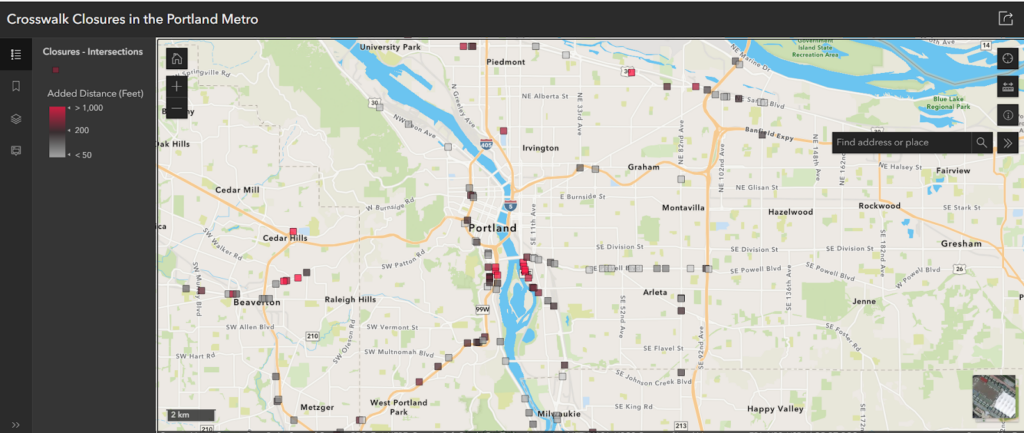
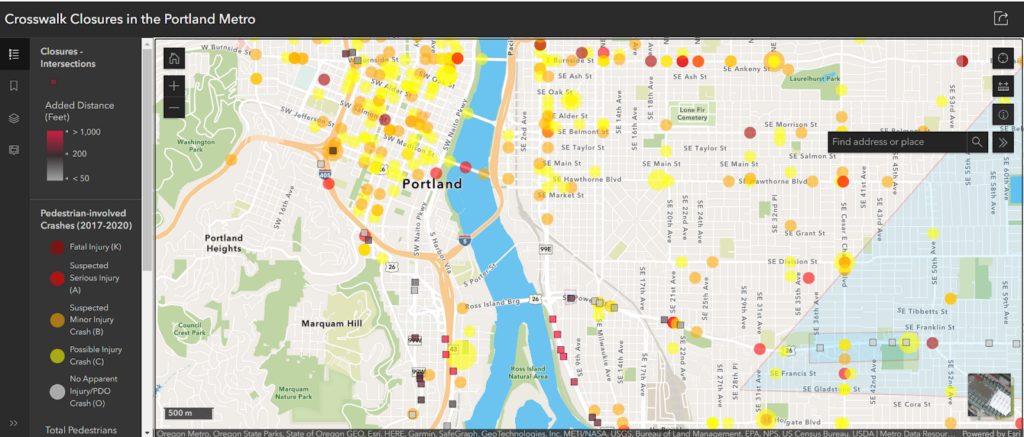
Over the course of a few months, Portland Community College students Robbie Ippolito and Donovan Murphy partnered with Oregon Walks to address the 181 recent sidewalk closures that ODOT announced in February of this year. In one of their spring Geographic Information Systems (GIS) courses, these two students created a phenomenal database that lets users explore a map that shows not only where the sidewalk closures are located, but provides detailed information about crashes, sidewalk completion, and distances to nearby crosswalks.
Pedestrians can use this information to inform how they travel around the region as these closures continue to be executed this year. On the Web App, users can search for an address to see which closures are near where they live, work, and recreate. Users can also zoom in to see different elements of the map, including crash data and sidewalk information.
Oregon Walks will continue to monitor these crosswalk closures. While we support the closure of dangerous crossings for the improvement of pedestrian safety, any work that is done to limit the movement of pedestrians around the region to advance and incentive vehicle travel is problematic. We envision a future where pedestrians are prioritized and people everywhere feel safe moving around their communities. We thank Robbie and Donovan for their excellent contribution to our work.